UK Parliamentary Constituency and Ward Maps

ElectionMaps blog

Constituency changes, local election results and the stories behind the map.

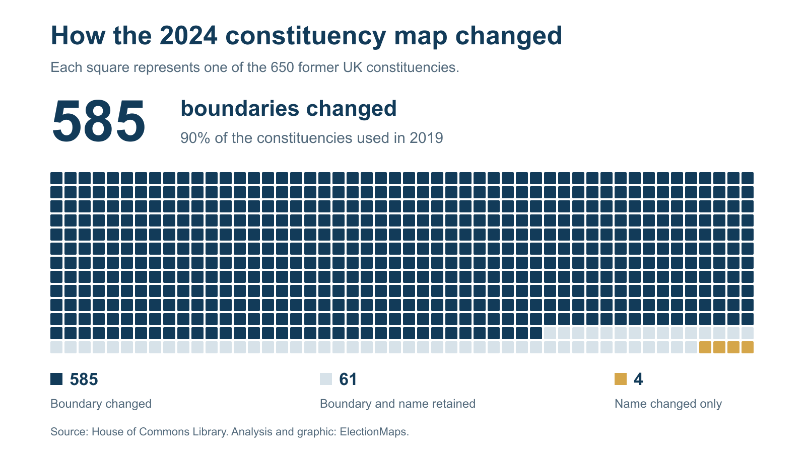
585 of 650 former UK constituencies changed boundary for the 2024 general election

90% of former constituencies changed boundary. A familiar name can hide a very different seat.

How constituency boundaries changed between elections

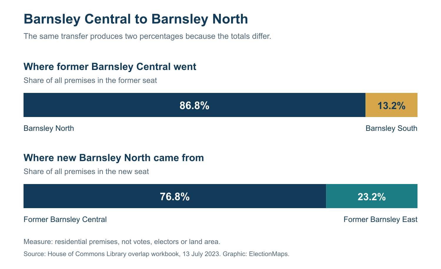
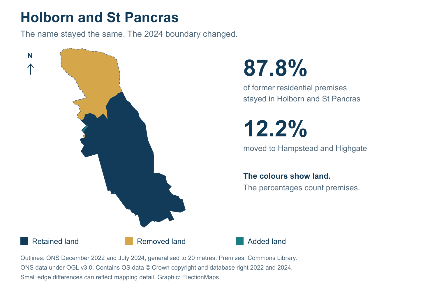
Newcastle upon Tyne North kept its name but less than half its former premises. Wales lost eight seats. We checked all 650 former constituencies to explain what changed between 2019 and 2024, with maps you can explore.
By ElectionMaps

Read the report

More reports and case studies

Council politics, elections and maps

Compare council areas, understand the election system and open the local data. Each guide links to the council pages and their sources.

Councils in London

Compare the 32 boroughs and the City of London. Check ward maps, seat snapshots and council tax figures.

Councils in Scotland

Explore 32 council areas and understand why first-preference votes do not tell the full STV result.

Councils in Wales

Find the 22 principal council areas, their election records and local statistics.

Councils in England

Distinguish counties, districts and unitary councils before you compare seats or population.

Put the results on the map

Compare the old and new constituency maps, or download the figures behind our latest report.