
North West Norfolk Boundary Change Map
Compare the former North West Norfolk boundary with North West Norfolk from July 2024. Buy a vector comparison map for £20, prepared and sent by email, or order a printed map.
Loading the boundary comparison…
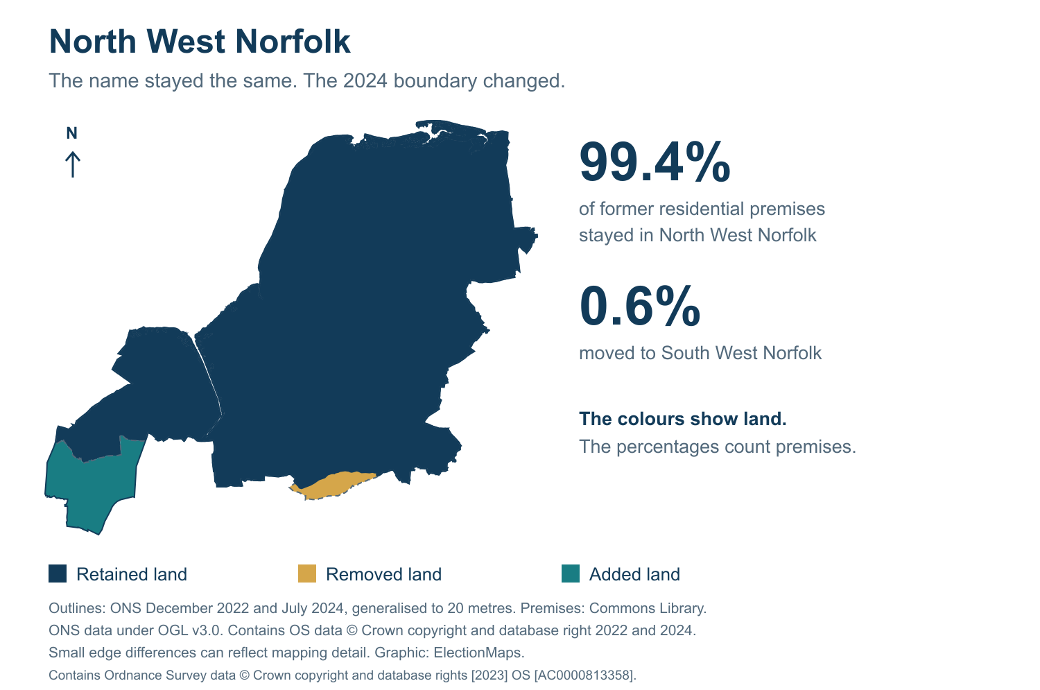
Dashed line: former North West Norfolk. Solid line: North West Norfolk from 4 July 2024.
Buy this Boundary Map
Vector map files cost £20.00 including VAT. Prints start at £41.00 including VAT and UK delivery.
2019 and 2024 boundary comparison
What changed in 2024?
The constituency boundary changed in 2024. The map compares the old area with its closest successor, North West Norfolk.
| Former constituency | North West Norfolk (E14000859) |
| Closest successor | North West Norfolk (E14001405) |
| New boundaries in use | 4 July 2024 |
| Old premises retained in this successor | 99.4% |
0.6% of the old constituency’s residential premises moved to other constituencies.
About the comparison map
The colours show land retained, removed and added when this former constituency is compared with its closest successor.
The tables show every linked constituency. Their percentages measure residential premises, not votes, electors or land area.
The preview uses 20-metre generalised boundaries. Small differences along an edge can reflect mapping detail.
View sources and datesWhere did the old area go?
Share of residential premises in the former North West Norfolk constituency.
| Constituency from July 2024 | Share | Map |
|---|---|---|
| North West Norfolk (closest successor) | 99.4% | View map |
| South West Norfolk | 0.6% | View map |
Rounded values may not add up to exactly 100%.
Where did North West Norfolk come from?
Share of residential premises in the successor constituency.
| Former constituency | Share | Comparison |
|---|---|---|
| North West Norfolk | 95.6% | This comparison |
| South West Norfolk | 4.4% | Compare |
Sources and dates
Comparison figures: House of Commons Library, workbook dated 2023-07-13. Constituency changes took effect at the 2024 general election. Ward memberships use 2023 boundaries.
Map outlines: ONS December 2022 (E14000859) and July 2024 (E14001405), 20-metre generalised boundaries. The map differences and premises figures are separate calculations. Boundary sources and method.
Source: Office for National Statistics licensed under the Open Government Licence v3.0. Contains OS data © Crown copyright and database right 2022 and 2024.
Browse all comparisons · View the current constituency map · Contact us about another map